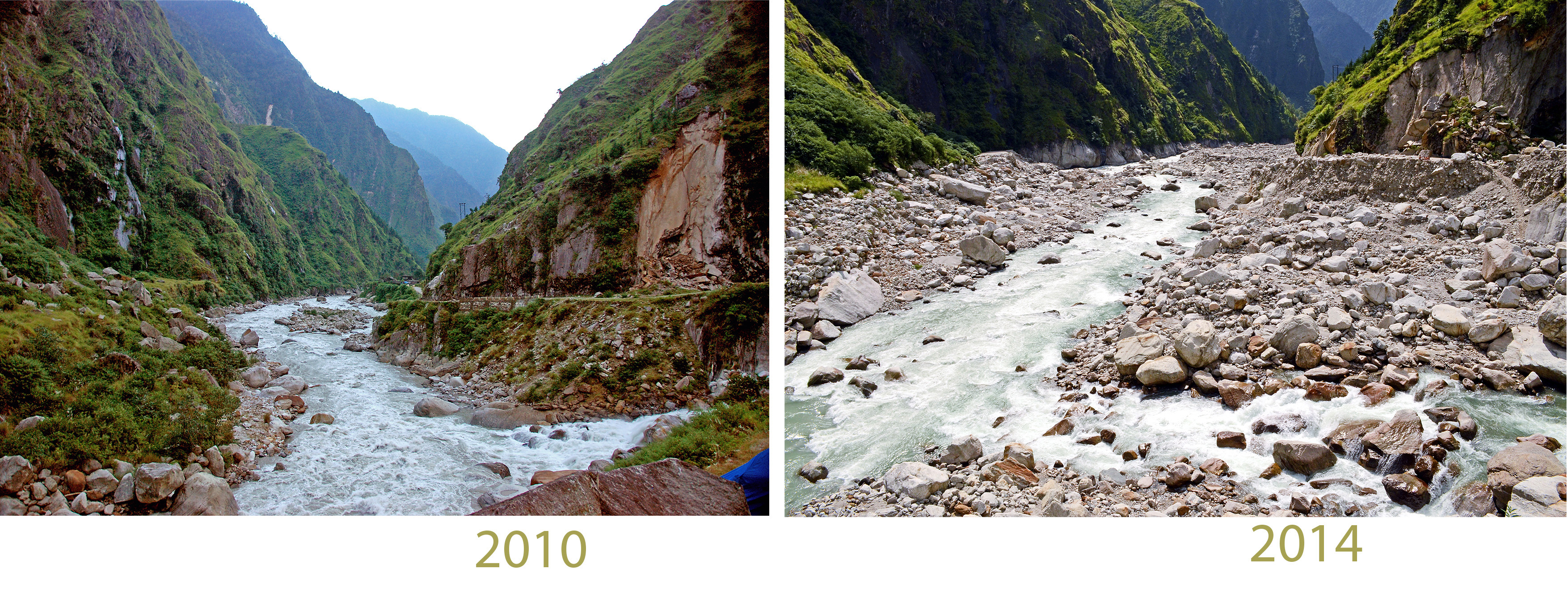
Torrential rains retooled a river valley in the Kumaon Himalaya. Here’s an account of the flood disaster with a few ‘before’ and ‘after’ images.
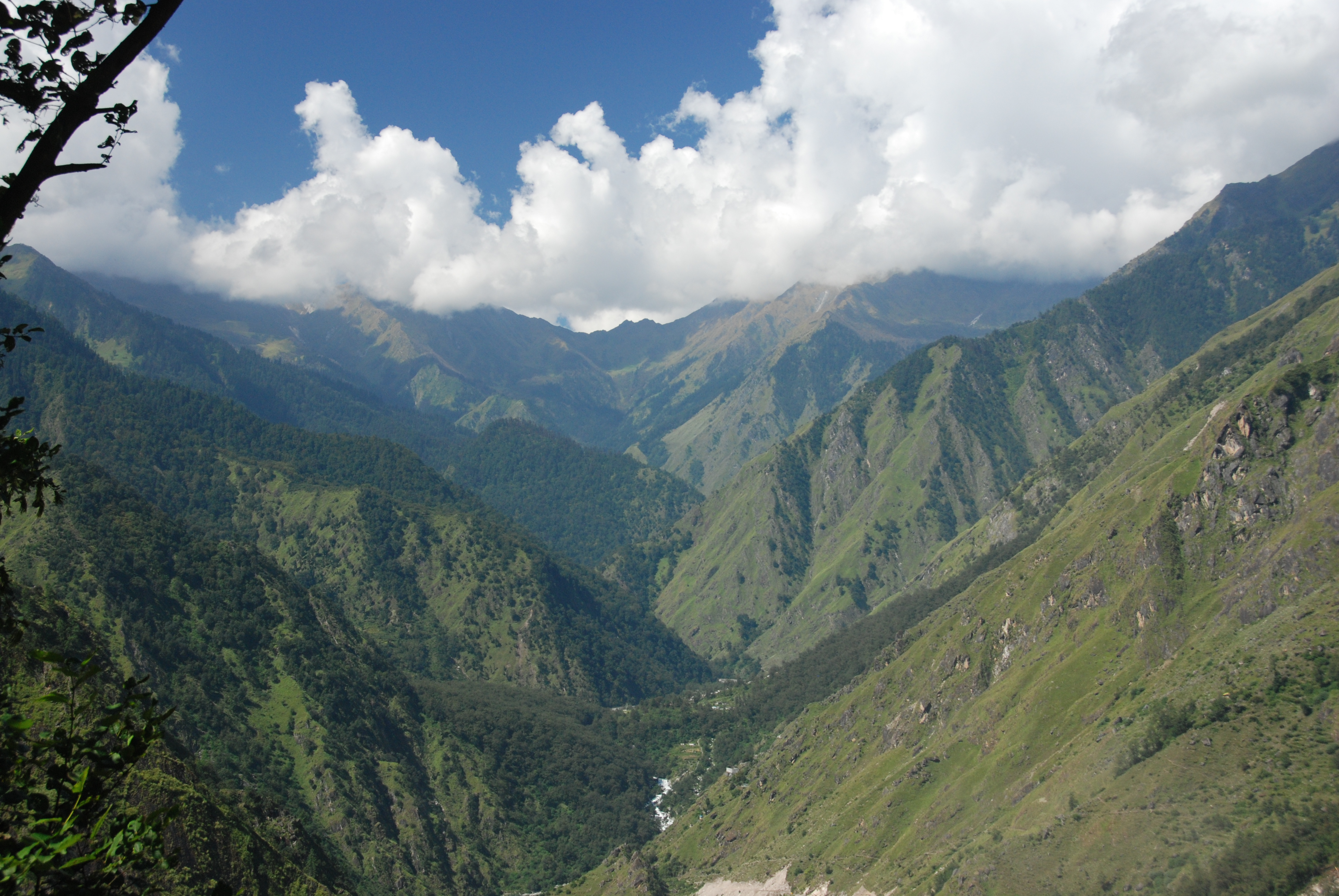
Over a three day period in mid-June 2013, the mountains of Uttarakhand, India got 60-90 cm (more than two feet) of rain. Lodges and shops around ancient pilgrimage sites at the headwaters of the Ganges river were washed away or buried in rock debris. Whole market towns, footpaths and motor roads were obliterated and more than 5000 people died.
Flooding was also severe in Kumaon, along Uttarakhand’s eastern border with Nepal. Here the 2013 flood retooled the Mahakali river valley and its tributaries including one place I’m somewhat familiar with called Darma valley. Seven times during 2009-2016, I have helped to bring university students into Darma Valley with the Wildlands Studies Program, a partner of Western Washington University and Wildrift Adventures, an iconoclastic Kumaon-based purveyor of adventure and discovery who provided fantastic logistical support and linkages with the Darma valley community that we could never hope to find elsewhere.
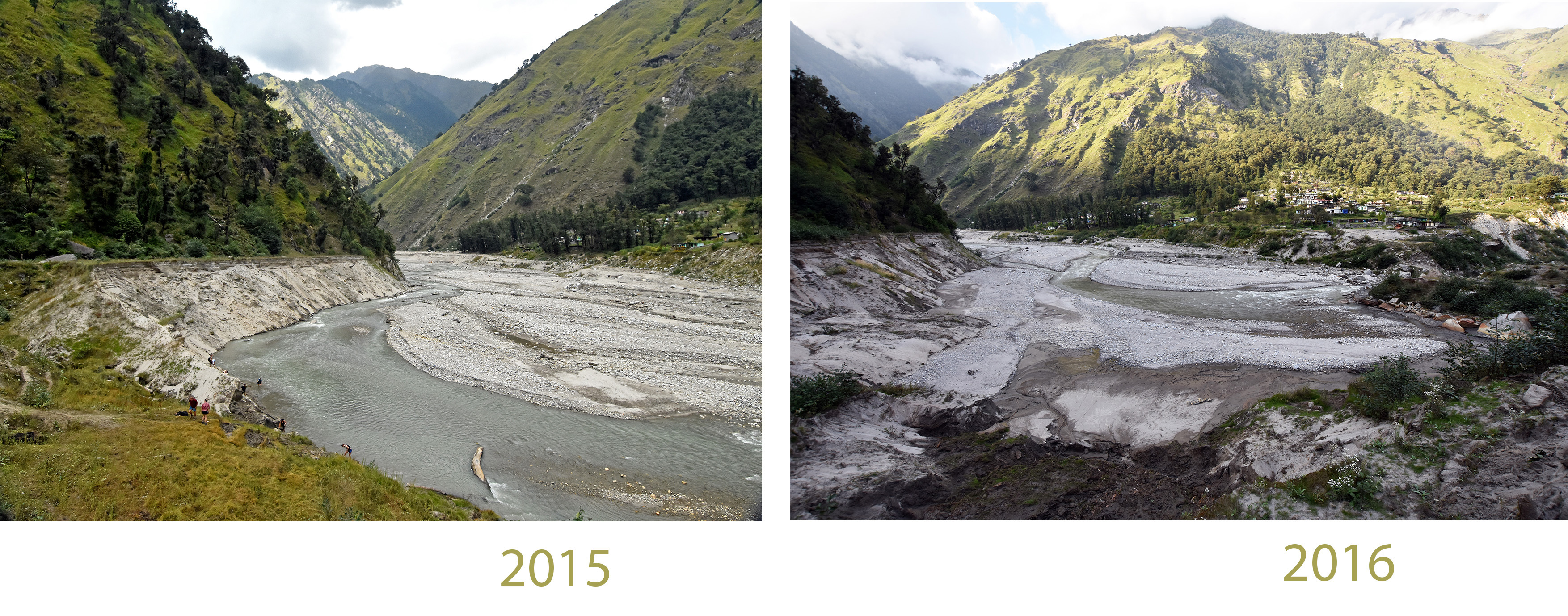
The Umachiya river drains into lower Darma Valley from the west. It is a small, steep catchment. During the downpour of June 14-17, a torrent of rock was borne down the Umachiya, past the village of Tejam, to enter Darma Valley just upstream from Sobla village. Much of the rocky debris originated from a meadow alongside Tejam, which was radically excavated during the storm. When this rock flow reached the main stem river of the Darma Valley, it reshaped the channel, destroying a road, burying the Sobla village and swamping a reservoir.While Sobla was almost completely buried, most of its residents survived because they had gone to the high mountains to collect Cordyceps caterpillar fungus to sell to China. Further on, the flood surge, arguably intensified by mismanagement of the reservoir, entered the Mahakali river, which was already raging, and contributed to the partial destruction of the town of Darchula. Most of the damage was on the Nepal side of the Mahakali.

The devastating rain of June 2013 was not a seasonal phenomenon. It was a westerly storm, swept in by the same atmospheric circulation patterns that normally bring heavy winter snow to Kashmir and the Karakoram mountains, several hundred kilometers further north. Like a California ‘Pineapple Express,’ this event incorporated humid air from the Tropics, borne northwestward at the onset of the monsoon. To a rough approximation, Uttarakhand experienced a full frontal storm with layered airflow, but one that came late enough in the spring and far enough south to tap water vapor from the incipient monsoon, which was massing on schedule over the Bay of Bengal and moving westward across the plains of northern India.
Meteorology
Robert Houze and his colleagues at the University of Washington provide a lucid analysis of the meteorology that brought all the rain to Uttarakhand in June 2013.
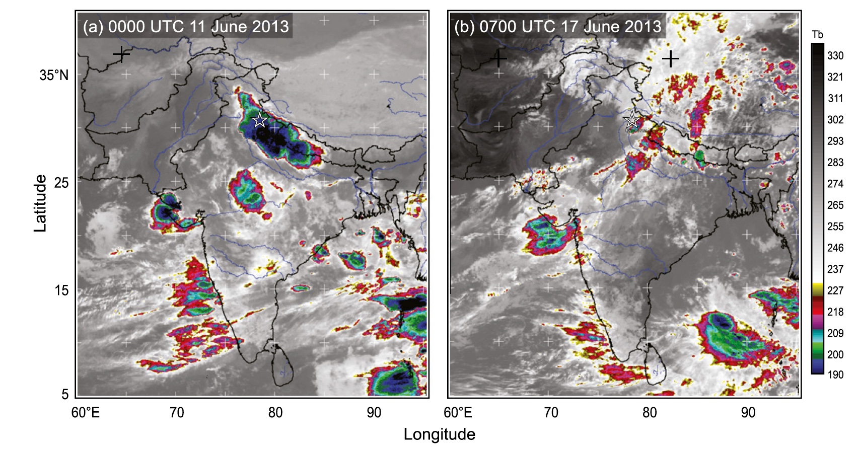
Seasonally, in winter, winds from the Mediterranean blow across Iran and the Caucasus mountains, bringing snow to the northwestern part of the Himalayan Arc. These westerly storms transport layers of humid air that ripple through the upper atmosphere, dropping heavy precipitation on Kashmir and Baltistan in the northwest Himalaya and Karakoram ranges. When the westerly storms cross the mountains, they generate heavy precipitation, but they are conservative in their expenditure of heat energy, unlike the boisterous convective storms of the summer monsoon, which inject heat energy into the upper atmosphere in a turbulent and explosive way, discharging gigavolts of electricity and condensing rainfall vigorously. That churning thunderhead on the afternoon horizon, a convecting cell of heat energy, might well be regarded as the currency of the monsoon. Energetic as it is, a monsoon convective cell is highly unstable and will dissipate in a matter of hours. Westerly storms play out on fronts that can be hundreds of miles long and last for days, tapping into an atmospheric plume of moisture drawn from far away.
Westerlies happen further north, in winter. The monsoon prevails further south, in summer, so normally the two kinds of storms don’t meet. In 2013, however, westerly winds veered southwards to cross the Himalaya in Uttarakhand, India just as the seasonal monsoon began to fetch humid air from the Indian Ocean. When these two systems joined, they generated a frontal storm that bore an exceptional amount of moisture.
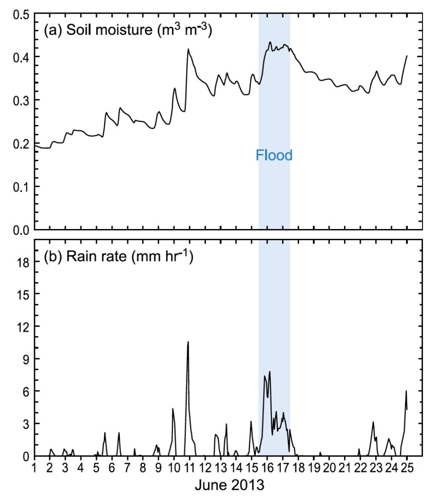
The big rain on June 14-17 was especially destructive because it happened immediately after strong convective storms (June 11-13) that saturated the seasonally dry soils with several hundred millimeters or rain. Landslide-enabling levels of soil saturation were already extant in Kumaon even before the big storm hit.
After the westerly current crossed the Uttarakhand Himalaya, it brought blizzard conditions to arid parts of Tibet. Holy Mt. Kailash got heavy snow at 5000 m elevation, causing much distress to pilgrims who were trying to circumambulate the mountain. On June 15, I happened to be in Dunhuang, a Silk Road oasis town in the Hexi Corridor between northeastern Tibet and the Gobi Desert. Here, soaking rain fell onto the sand dunes for much of the day, part of a storm pulse that would drop 30 mm of rain, more Dunhuang normally receives in an entire year.
The Excavation of Tejam Meadow
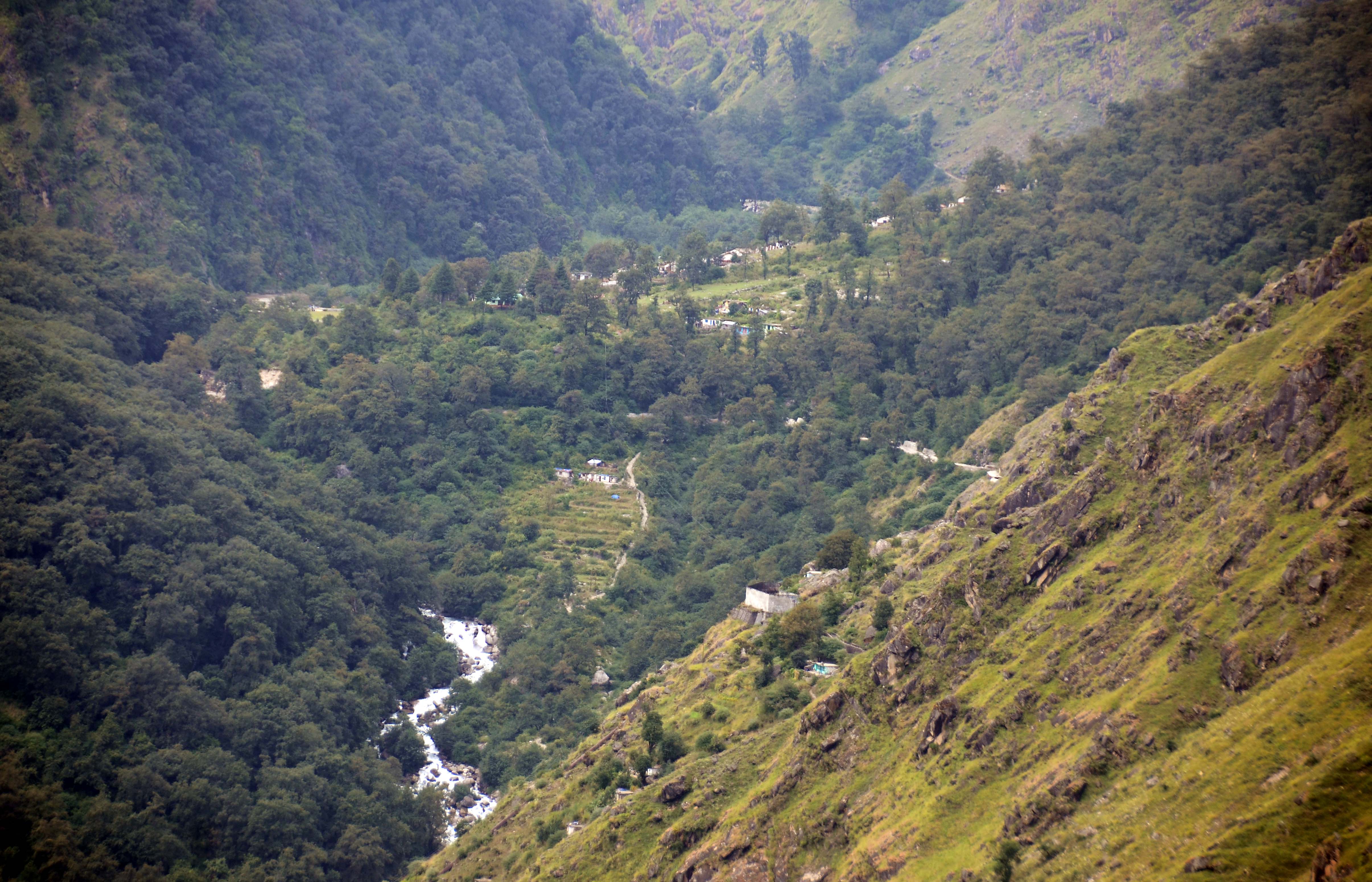
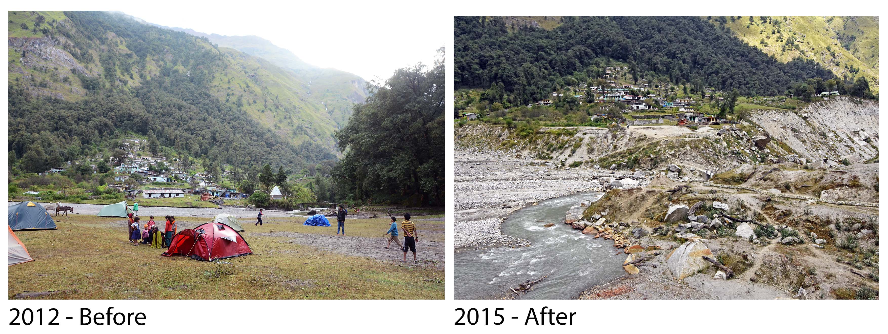
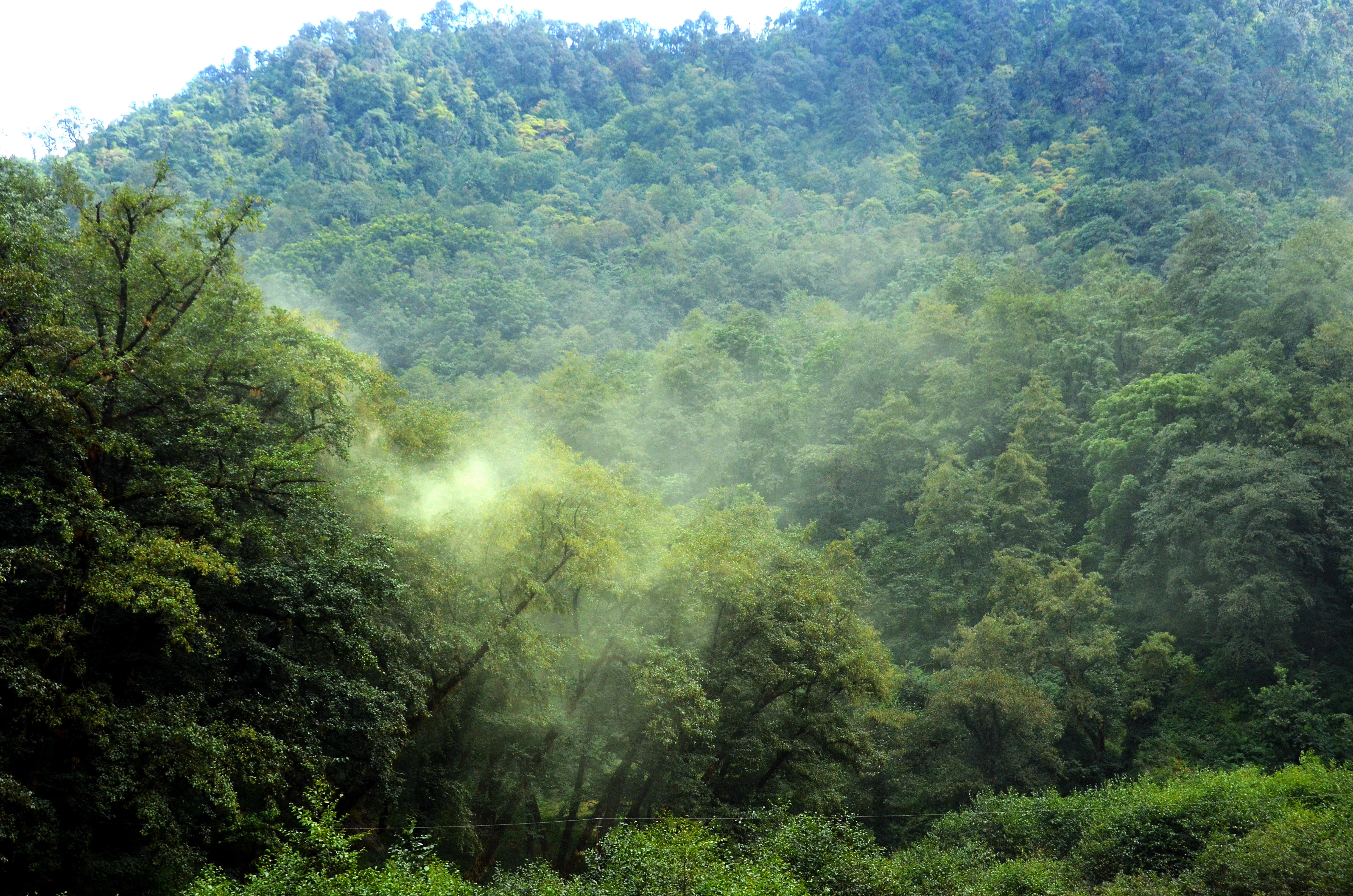
The meadow across from Tejam Village used to be the biggest, flattest camping ground in the lower Darma Valley. Generations — perhaps a century — ago a landslide, medium-sized by Himalayan standards, came down opposite where the village is today. One imagines how, in a grinding roar and a cloud of pulverized rock dust, this slope failure it blocked the valley, impounding the stream to form a lake, and how over decades the lake filled with sediment to produce the landscape we saw in 2012, a broad sandy meadow covered in grass (or small plants that look like enough like grass that it doesn’t matter) and a braided river channel so shallow that you had to lie down to bathe. Today the landslide’s terminal debris pile is covered with hulking alder trees, more or less uniform in size. Since Himalayan alder is a pioneering species on landslides, perhaps this cohort of trees marks its age. In 2012, after passing the landslide and leaving the meadow, the Umachiya river plunged through boulders, dropping 250 meters to enter Darma valley’s main river, the Dhauliganga.
In short, in 2012, Tejam meadow was an iconic example of the sort of aggraded landscape that develops as the consequence of a valley-blocking landslide, as Kenneth Hewitt has described so well.
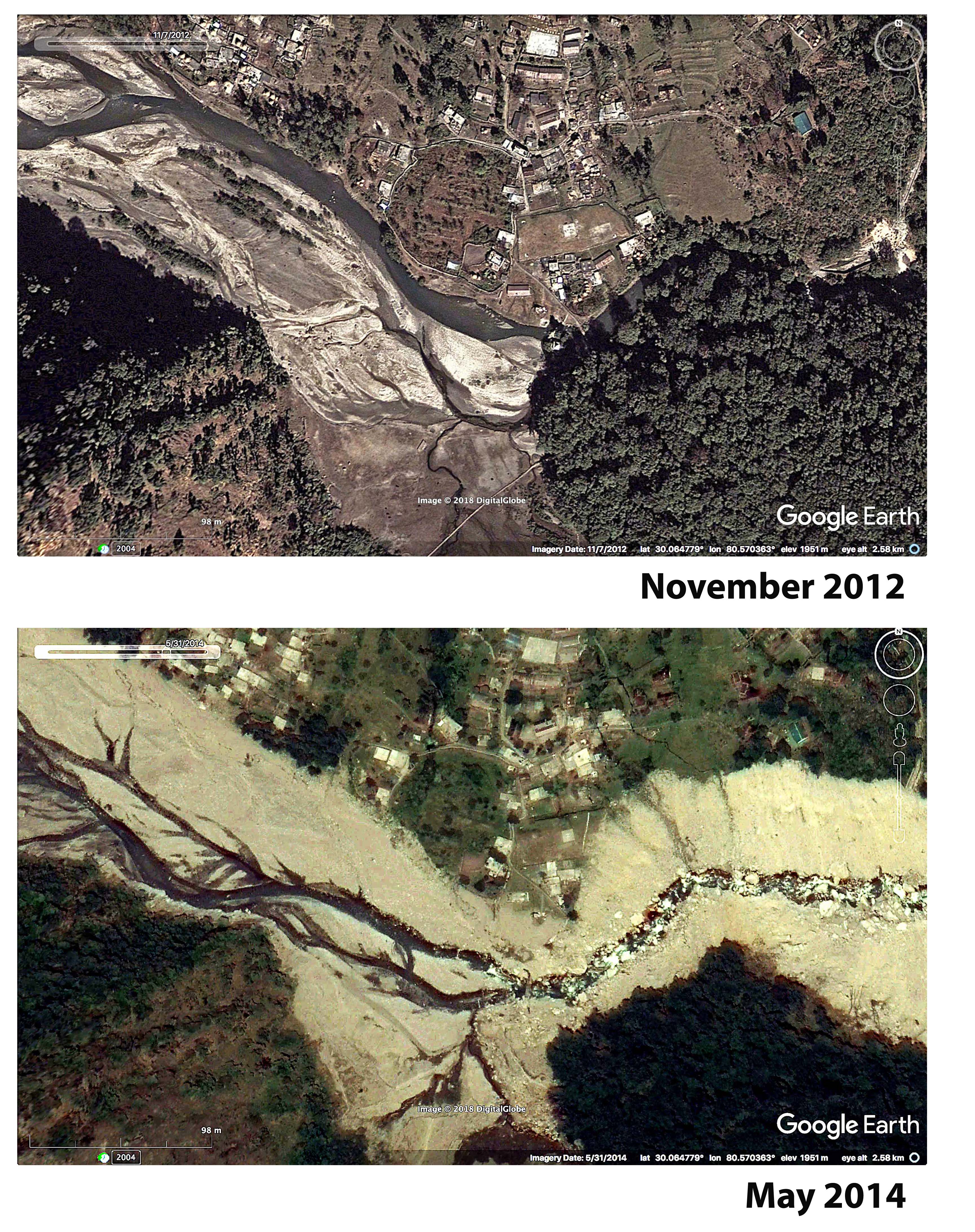
This landscape was altered profoundly by the flood in 2013. The flood waters and the rock they transported incised a channel through the dam, and the then, accelerated by its new, steeper pitch, the river cut swiftly headward, washing out what I estimate to be about 3 million cubic meters of impounded sand and rocky debris. This washed down into the Dauliganga river, retooling the confluence, burying Sobla village and contributing to the destruction further downstream.
When we returned to Tejam in October 2014, we saw that the landslide dam at the foot of Tejam meadow had been truncated in a spectacular fashion and that most of the meadow was gone, explaining the likely origin of the rock the buried Sobla. Where the meadow had been was a rock-bound, flat-bottomed gully that held the Umachiya river at an elevation 15 m lower than it had been two years before. Upstream, sheer valley walls were exposed. Closer to the old landslide dam, remnants of the meadow still held.
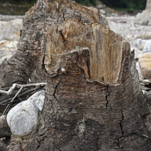
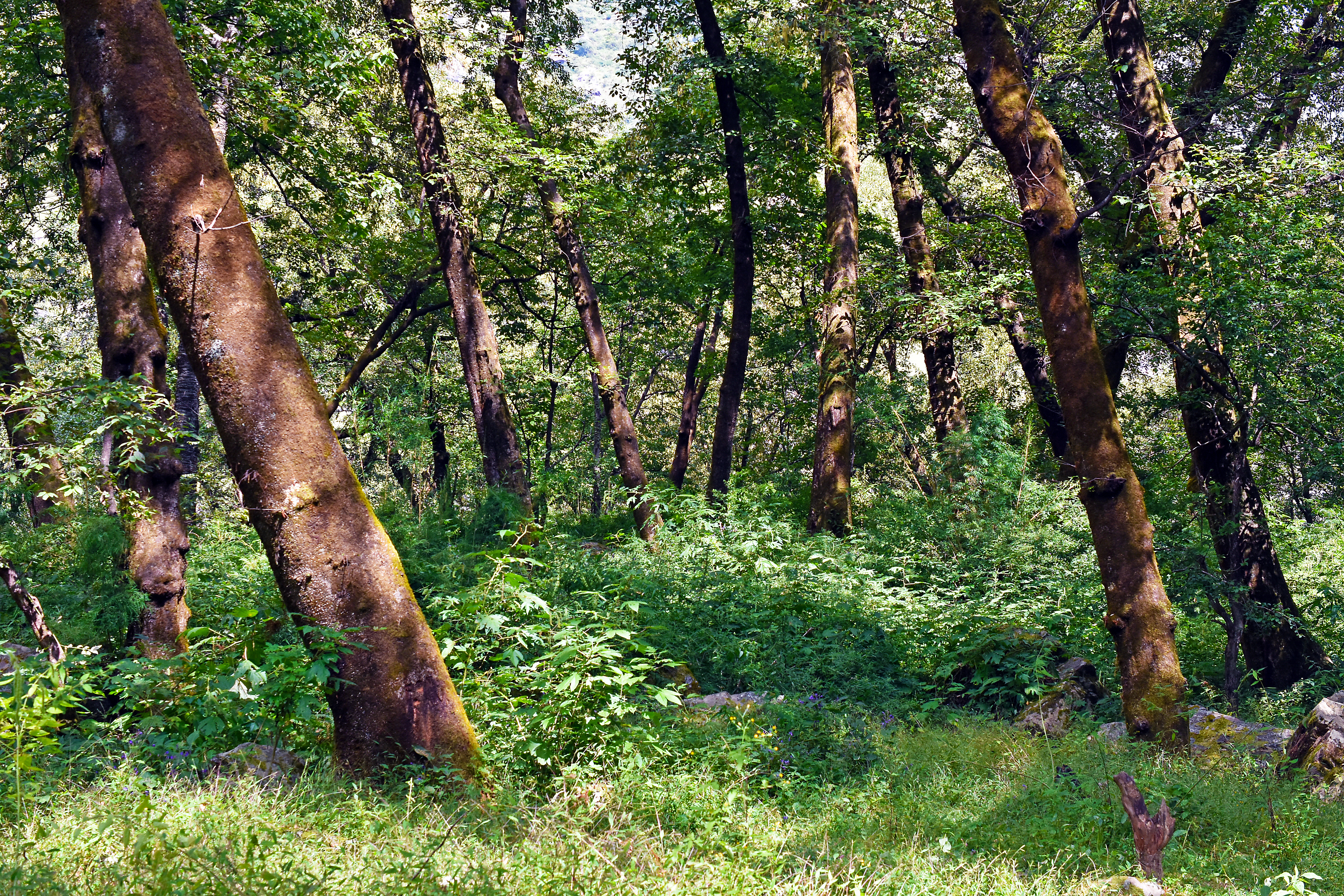
In the upper reaches of the excavated meadow, there had been less infilling and here the standing trunks of old trees, drowned after the landslide and then buried during aggradation of lake to meadow, had been recently exposed. One specimen could be recognized as a birch, others as alder; some might have oak, which are abundant on nearby stable slopes.
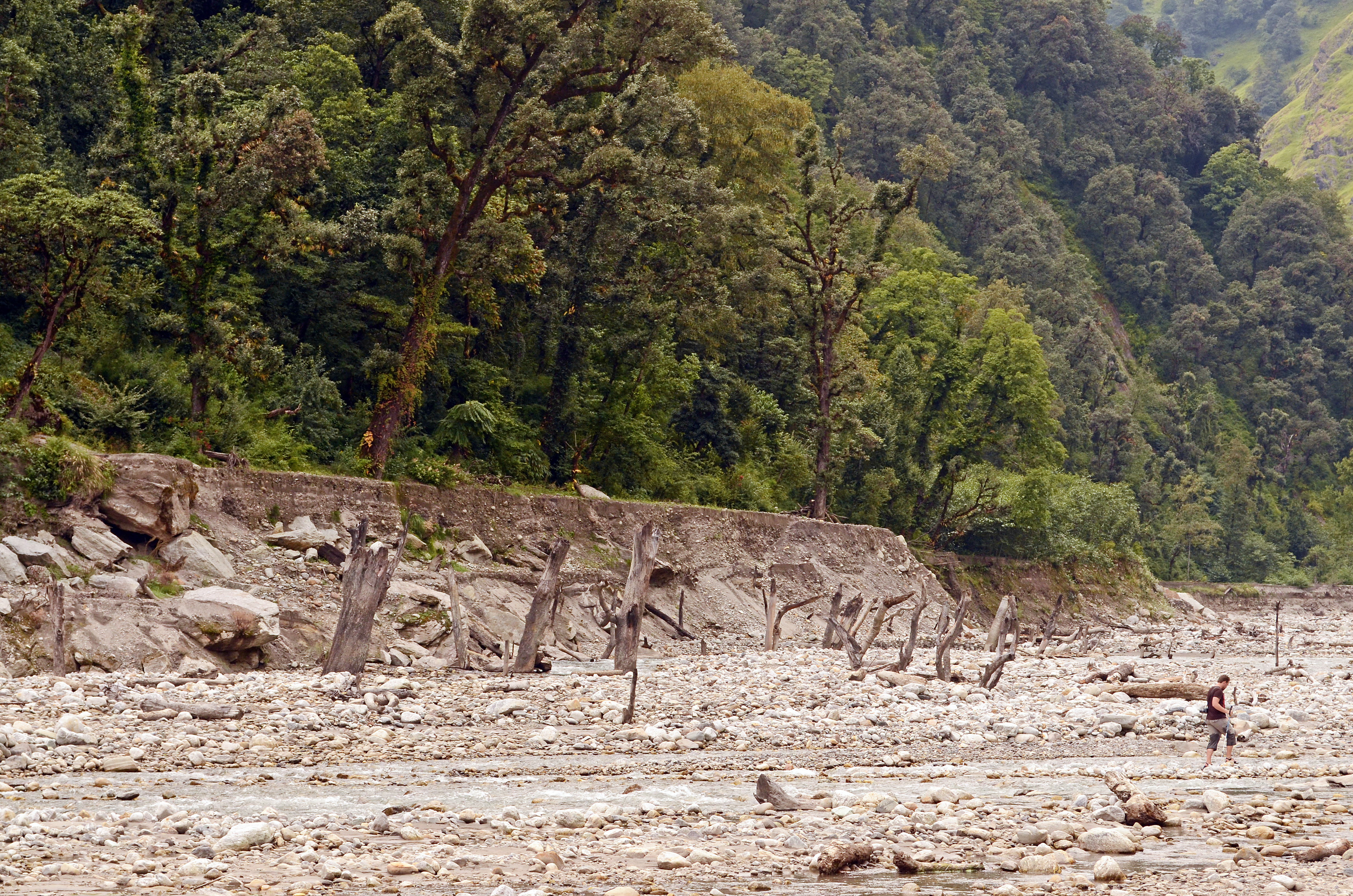

Old tree trunks that had been buried during the aggradation of a landslide-formed lake were exposed after the 2013 flood. We see Alnus alder, Betula birch and Quercus oak.
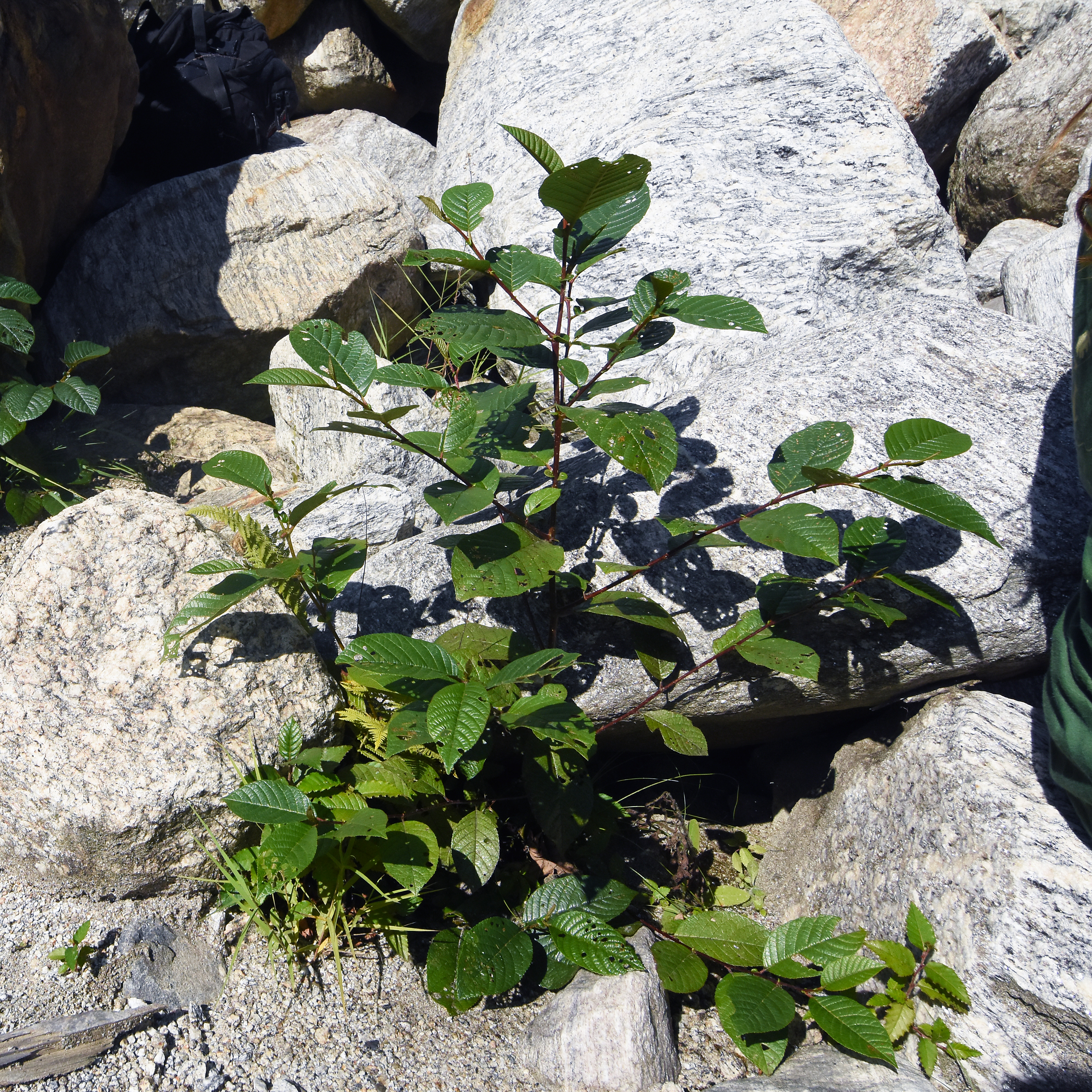
In the post-flood years, 2014-2016, the terrace where we camped continued to change. Erosion ate away the terrace along a sandy slope, with steep-sided ravines cutting inward. And, as the water table dropped, vegetation changes from a sandy plain sparsely covered by grasslike plants to a more woody habitat with various borages (sky blue flowers and obnoxious seeds) and young alder responding favorably to the airy soils.
Basically, Tejam meadow illustrates the entire cycle of instantaneous slope failure and dam formation, rapid lake filling, gradual aggradation from lake to plain, and then destruction of the plain in an episode of rapid incision and headward erosion that Kenneth Hewitt describes for tributaries of the Indus river. Tejam differs from the places Hewitt has studied because it is much wetter, giving it a different flood regime and vegetation dynamics, and because it is relatively small. The Tejam landslide might have moved five million cubic meters of rock; the minimum size for a landslide to be included in Hewitt’s Karakoram is twenty times that volume.
Like many streamside meadows, Tejam couldn’t drain easily because it sat at the level of the water table. Soils, waterlogged for months on end, maintained an arrested state of ecological succession where grassy species prevailed over the shrubs and trees that would replace them in airier soils.
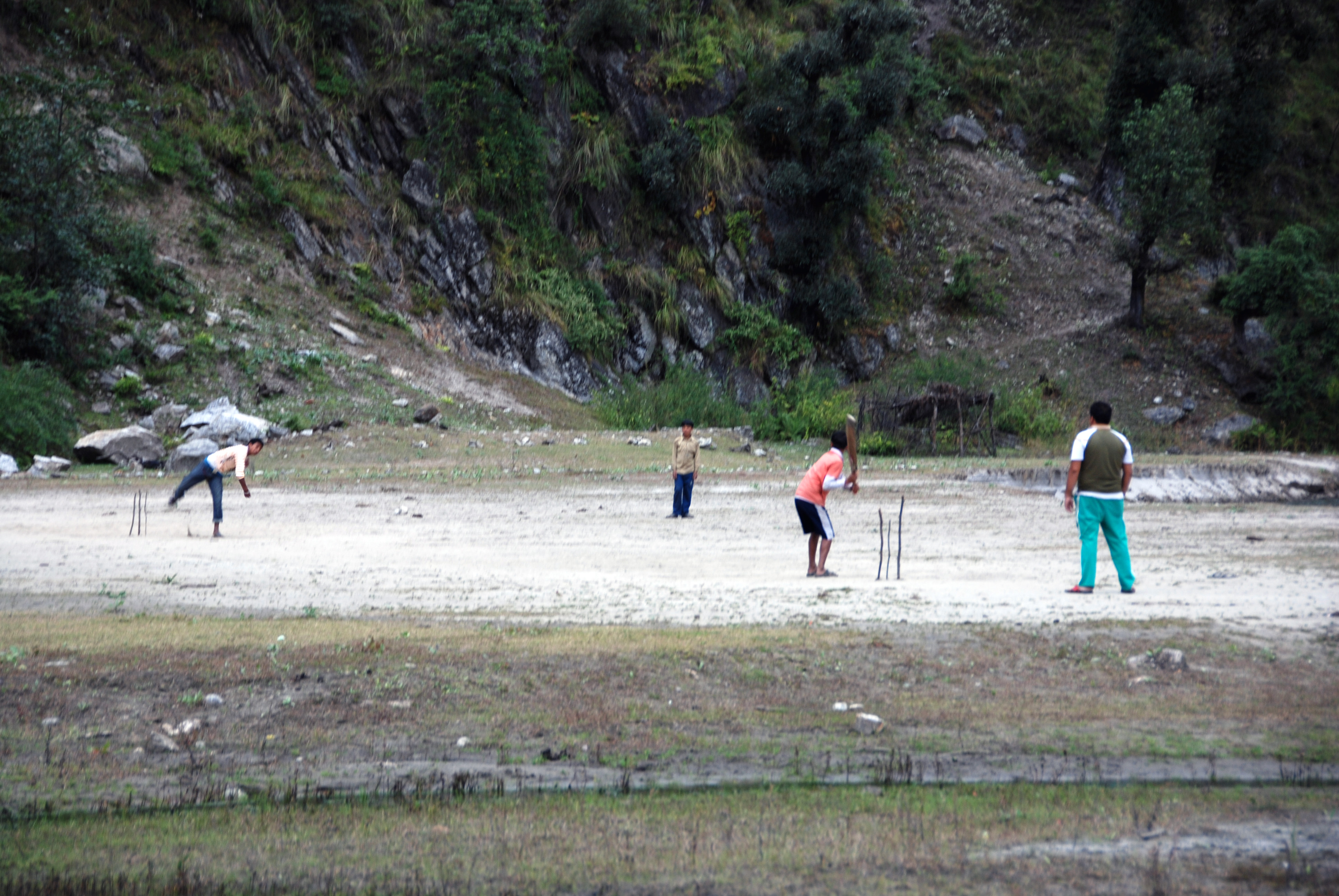
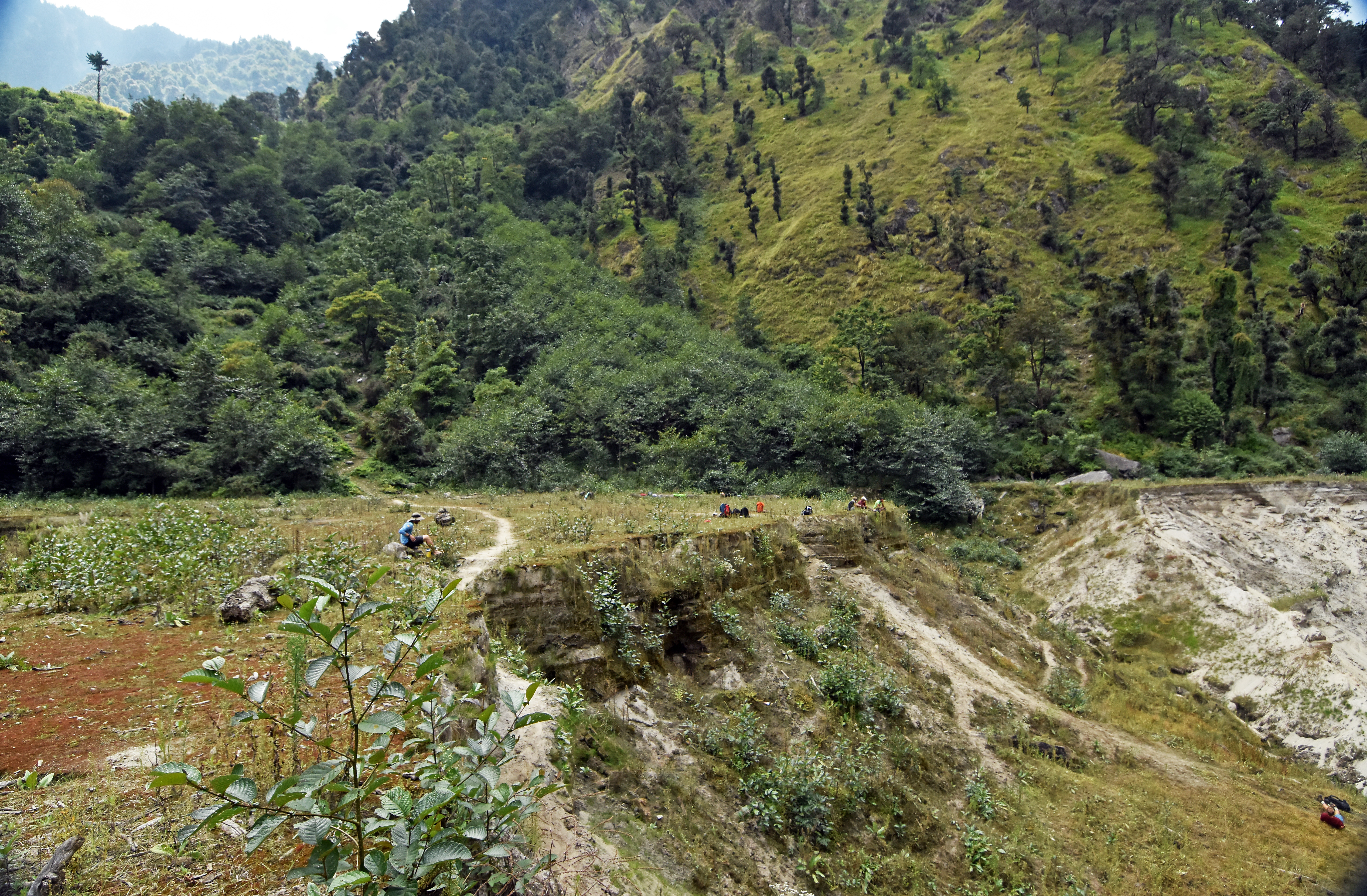
After the meadow was lost and the river dropped, the water table on the remaining meadow terraces dropped as well, providing fresh air to the roots of young alder that responded with vigorous growth. By fall 2016, there were only traces of the meadow, dissected by gullies and separated from the river by a wet, crumbling escarpment of sand and partially decayed plant material that created a rank, unwholesome milieu. Trails to the meadow, disused now, are being overgrown with pioneer species like stinging nettle and borages whose seeds implant themselves permanently in fur, socks and bootlaces.
The Sense of Alder
The tree called Himalayan Alder (Alnus nepalensis) is germane to catastrophic erosion in the Himalaya because it is the number one pioneer and stabilizer of slopes that fail at a wide range of elevations including most of the elevations where people live. Here in Tejam, the lobe of rocky landslide debris that held back the meadow until it was cut in 2013 supports a magnificent forest of Himalayan alder. The trees are mature and appear to be about a century old, maybe more. Like other pioneering plant species, a Himalayan alder tree maximizes reproductive fitness in an uncertain world by producing copious wind-borne pollen and potentially great numbers of nutlets, tiny seeds about 2 mm long with membranous wings that disperse in the wind so uniformly that when gravity pulverizes an expanse of bedrock, or the river deposits a fresh terrace, alder babies seem to erupt spontaneously from the damp sand and mica.
Himalayan alder, with the help of symbiotic root bacteria, can take nitrogen gas from the air and ‘fix’ it, which means putting the nitrogen atom together with hydrogen or oxygen to make chemical compounds essential to growth. In this way, Himalayan alder is less reliant on the nitrogenous waste of other organisms: self-sufficiency is useful to pioneers.
When we visited Tejam in 2012, those big alders on the landslide lobe made an attractive backdrop for our campsite, as well as a backstop holding in place the meadow we camped on. The lower part of the meadow, backed up against the old landslide, could not drain well, so it had grasses, but no trees. Young alder were testing the margins.
The Tejam Villagers
Tejam is one of the higher villages in Darma Valley that is inhabited year-round. Residents of the Darma Valley, who refer to themselves as Rung, have a trans-Himalayan ancestry. Today they identify Hindu, but their genetic heritage and cultural traits show an affinity with Tibet. A couple of generations ago, the Rung were accorded Scheduled Tribe status, providing opportunities for higher education and government service that has encouraged them to steer away from traditional livelihoods. Catastrophes like the 2013 flood must further demote the appeal of traditional livelihoods to the next generation of Rung.
Rung people have a history of transhumance, spending the warm part of the year in high valleys where they grow buckwheat and graze livestock, and over wintering in the Mahakali river valley. Various pressures make this lifestyle problematical for the next generation of Rung people, but people from the Mahakali Valley do seem to value their summers at high elevation. Road construction to the highest inhabited elevations of Darma Valley threatens to be a big disrupter of local traditions, but the road is popular nonetheless because it means visits to the summer village can be shorter and more frequent.
Later I want to write about some interesting places in the upper Darma Valley, including the high elevation byaksi, tributary valleys that hold tremendous scenic and religious importance to the local people.
Photo credit Maria Vishnevskiy
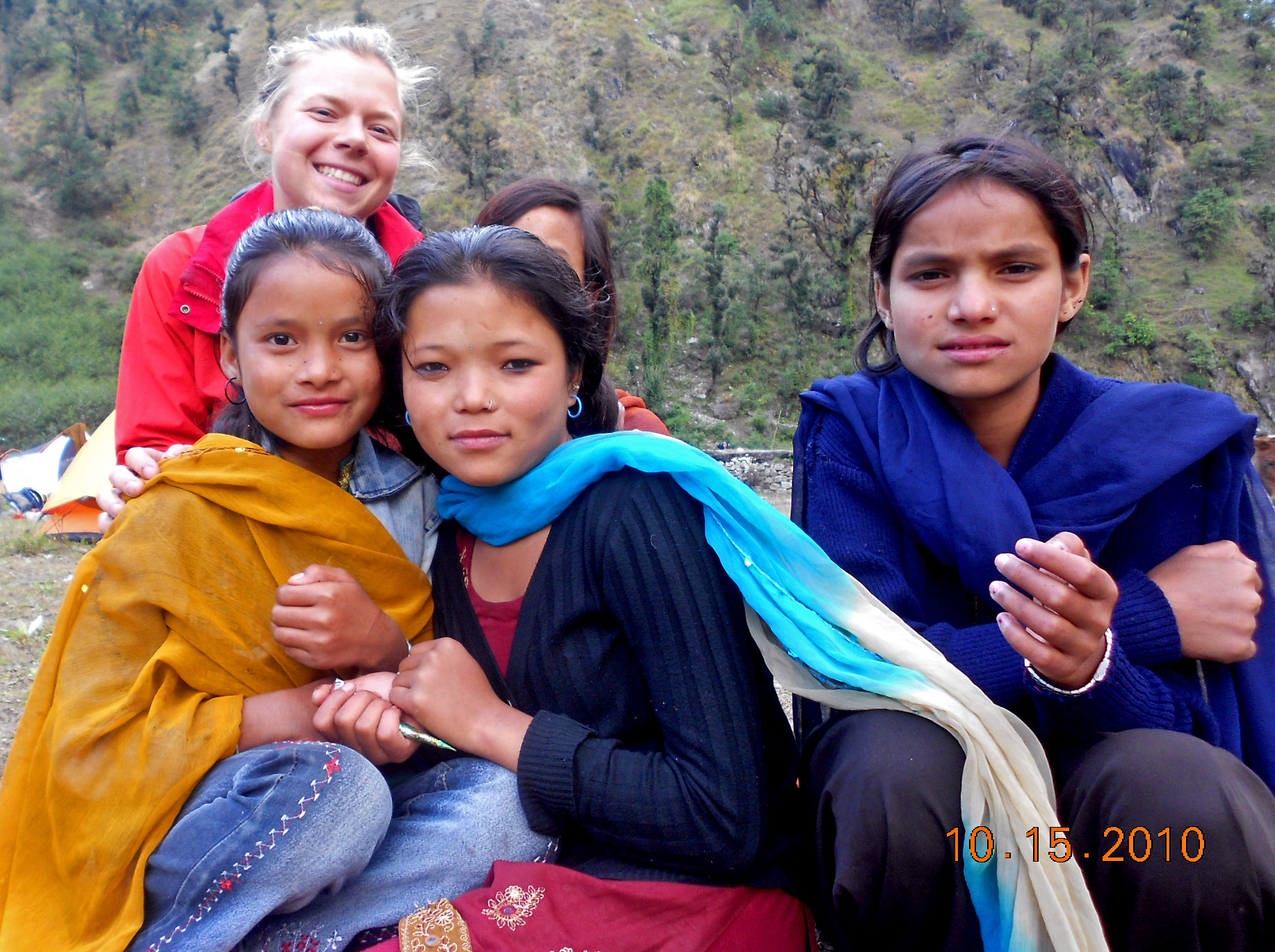
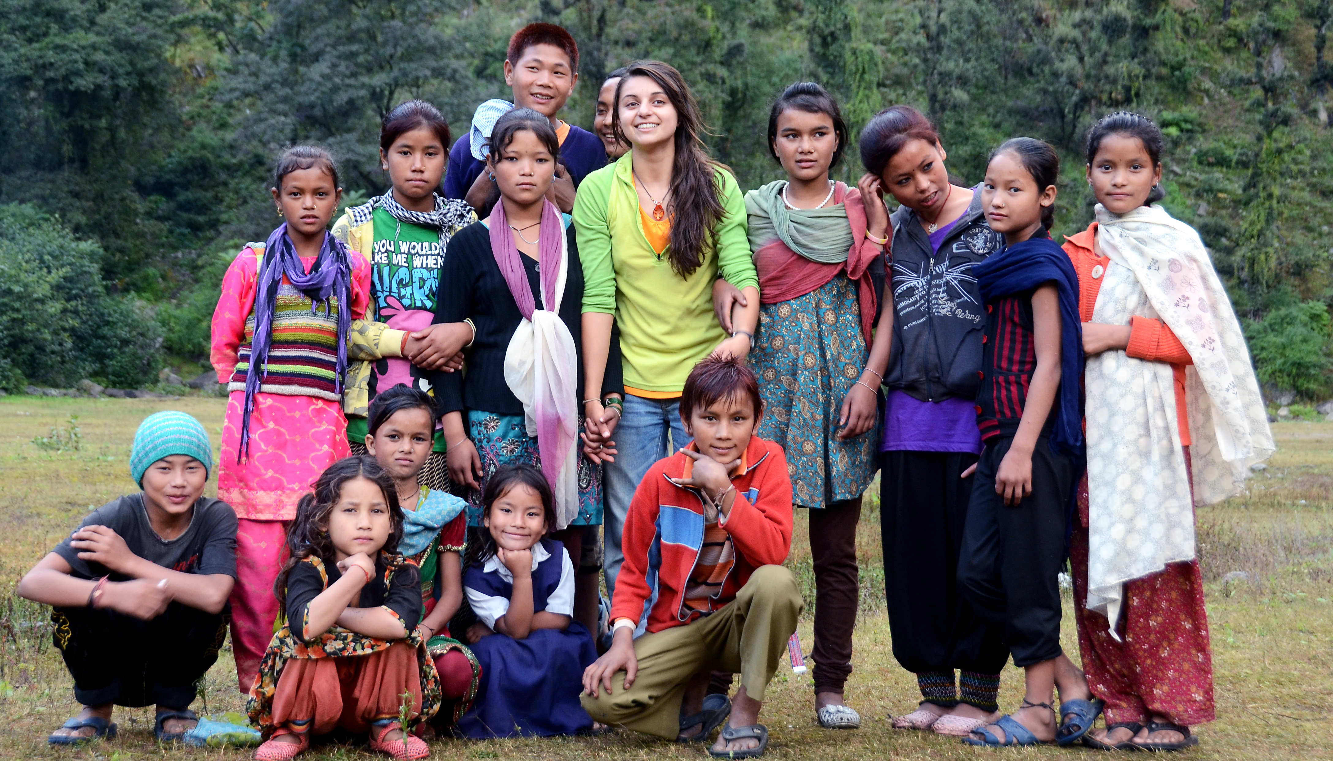 Tejam kids with Wildlands students in 2010 and 2012. Before June 2013, it was easy to cross from Tejam village to our campsite, so the kids often came over to check us out.
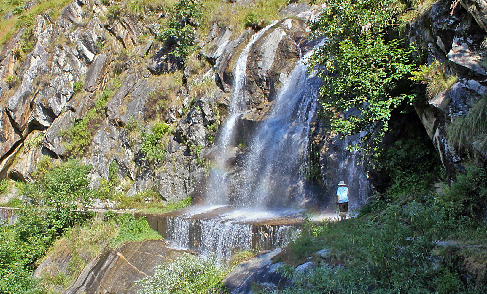 After the landslide, access to Tejam became more complicated. In 2014, the best way to get from Darma Valley to Tejam was to follow this irrigation canal, which during the post-monsoon meant scampering through a waterfall.
