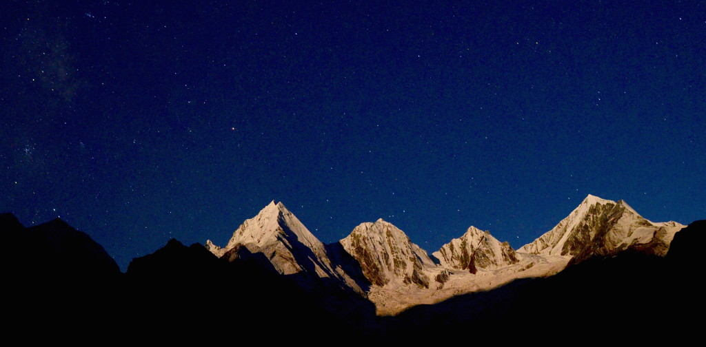
When I was a graduate student in 1986, planning to visit China, I got hold of Joseph Rock’s Ancient Nakhi Kingdom, two volumes published by Harvard Yenching Institute in 1948. Mixing ethnography, botany and adventure in the corrugated mountain landscape of southwest China, Rock’s prose was impenetrable to me, a tangle of unfamiliar place names, botanical references, and Chinese characters. But the photographs were superb. Natives in ceremonial dress outfits, peasants or maybe slaves whose clothing and faces revealed subhuman poverty. There were images as well of mountain landscapes, and the ones that enraptured me the most showed a group of peaks called Konkaling, three summits, each about 6000 m tall, each named for a Tibetan deity who embodies a quality worth having: Jampelyang (Wisdom), Chana Dorje (Power), and Chenresig (Compassion).
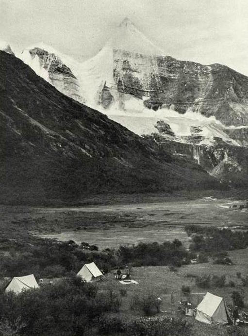
Jambeyang, Chenrezig, and Chanadorje (Joseph Rock, 1928) (c) Nat Geog Soc.
The Konkaling peaks are not particularly massive by Himalayan standards, but they are well-formed of striated limestone with perennial snow at the top. Jampelyang’s arcing symmetry could have been sketched by a child from some place where there are no mountains at all.
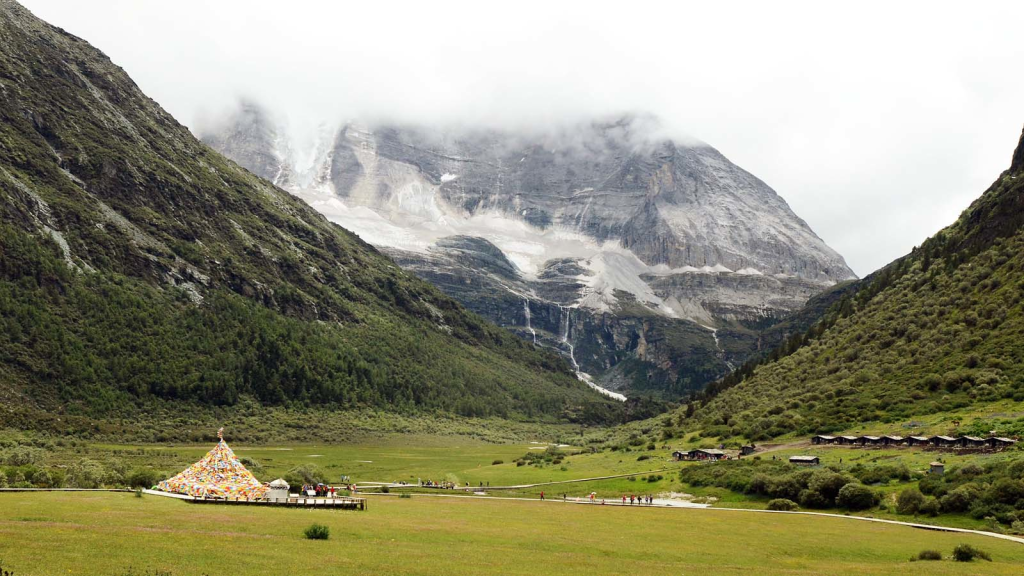
*Luorong Pasture in 1928 and 2014
When Joseph Rock visited the mountains of Konkaling in 1928, he found them to be anarchic and full of bandits, much like the other Chinese hinterlands in the years leading up to Liberation. Konkaling is the upper watershed for an area that Rock called the Kingdom of Muli, and it was the Muli king who got Rock and his men the bandit-protection they needed to visit Konkaling and come back alive. Rock’s makes a colorful account of this journey in a 1931 National Geographic article ‘Risumgongba, Holy Mountain of the Outlaws’.
Rock spent much of his time in southwest China exploiting the possibilities available to a willful and narcissistic, linguistically-talented wannabe aristocrat operating in the grassroots of a nested hierarchy of failed government. At the national level, the Qing Dynasty had collapsed and strongmen were fighting over fiefdoms. In Kham, a Chinese warlord from the north had deposed local Tibetan chiefs and, in the power vacuum that ensued, a lama came up from northern Yunnan to control bands of rogue monks who respected the lives of animals, but wantonly robbed and killed members of their own species. When the Chinese military came in, Tibetan outlaws attacked their garrison and stole weapons. By removing local Tibetan authority, the Chinese lost access to much of the river gorge area, especially the places that are now the counties of Daochang and Xiangcheng in the very southwestern corner of Sichuan. This meant two important kinds of travel, trade and pilgrimage, couldn’t happen: the country Rock visited in 1928 had seen no commerce at all for more than 20 years. Rock made it to Muli only once. He wanted to go back, but a crop-destroying hailstorm that occurred soon after his visit was interpreted by the lama as a sign of displeasure, and he was told that he’d be killed if he tried. Or maybe the storm was just an excuse, maybe the bandit-pilgrims just didn’t like having him around.
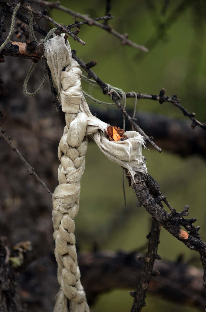
Rock has much to say about natural beauty, human treachery, personal hardship. His lifetime devotion to the dongba tradition of the Naxi priests — a pictographic language for religious ritual — shows much sensitivity to vernacular culture, but Rock remained dismissive and incurious about the cultural heritage of the Konkaling Tibetans. “Outside, tied to posts, were all kinds of offerings, left there by perambulating pilgrims — bracelets, rings, beads, feathers, bells — even hairs. There was nothing beautiful whatever, only filth and evil smells.”
The Western conception Tibetans as gentle, spiritual and politically correct sort of people would start coming out a couple of decades later. In the meantime, Rock could remark drolly of “Mani piles [of prayer stones] … testifying to the great leisure of the lama monks who are responsible for their presence… They lead a monotonous existence, ever praying, and turning wheels and mills of prayers and chiseling prayers into every available flat rock surface.” Faced with thousands of mani carvings on riverside boulders, one of my Chinese traveling companions said the same thing.
Rock had to leave southwest China after the Communist Revolution in 1949, and the whole river gorge area was closed to foreigners for more than 30 years. In 1984 a delegation of mountain experts visited the the Naxi minority prefecture of Lijiang, which had been Rock’s base. The backpackers arrived at almost the same time, setting up in ‘open’ places like Lijiang, then probing around to find out which of the ‘non-open’ places really were closed (i.e. you’d get expelled on arrival with a small fine) and which of them would tolerate foreigners for a few days at least. Through my backpacking days, Konkaling stayed closed, and fortunate as I was to visit lots of exciting places in southwest China in the decades of Deng Xiaoping and his successors, I would not get to Konkaling until this year.
The post-1949 history of Konkaling is obscure. Perhaps some of the local Tibetan people appreciated the law and order, and the release from serfdom that the People’s Liberation Army brought in the early 1950s. This seems to have been the case in some parts of northwestern Yunnan, if not in the Khampa regions further west. And certainly much of ecological and cultural value was lost when Chairman Mao’s policies started going awry in the late 1950s. I had no problem staying in Yongning, near Lugu Lake in 1988, but was not allowed to enter Muli from the Liangshan Mountains in 1989. Access via Zhongdian in northern Yunnan was also restricted until the late 1990s. Westerners started to appear in Konkaling (now Yading), around 2000. Among the first groups were film makers from National Geographic and some mountaineers; the latter were controversial because many who care consider the Konkaling peaks too sacred to step upon. At any rate, it seems, no climbing permits where granted and no serious attempt was made. Howman Wong’s Hong Kong based China Research and Exploration Society also made visits to Konkaling in the 1990s.
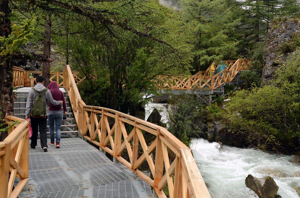
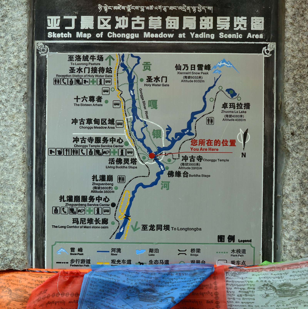
The three Konkaling Peaks and the valleys around them are now called Yading Nature Reserve. Soon after the Reserve was gazetted, the government established bus access into scenic Luorong Valley, obsoleting the local muleteers, generating violent protests. Since then, green buses, boardwalks, and admission fees have been cloned-in, replicating a model common to southwest China’s other scenic locales: Jiuzhaigou, Yulong Shan, Pudacuo, Siguniang Shan. Yading is a nationally-ranked scenic site and a UNESCO Biosphere Reserve. Entry costs 150 yuan, the compulsory green bus adds 120, and the optional electric tram from Chonggu Monastery up to Luorong Meadow costs 50 yuan, so the experience of spending a day at Yading comes to about USD $50 per person per day. Getting from Riwa into the nature reserve, queuing for tickets, green-busing it up to Chonggu Monastery, walking one way on the plank way to Luorong Meadow, then taking the electric tram back to Chonggu, goofing around for awhile and green-busing it back to Riwa takes exactly one full day. The tourist plank way looks freshly built, a walking corridor of elevated metal grid with stout wooden railings to keep the tourists from stepping into the wild. Trees have been spared ostentatiously, growing up through gaps cut in the metal.
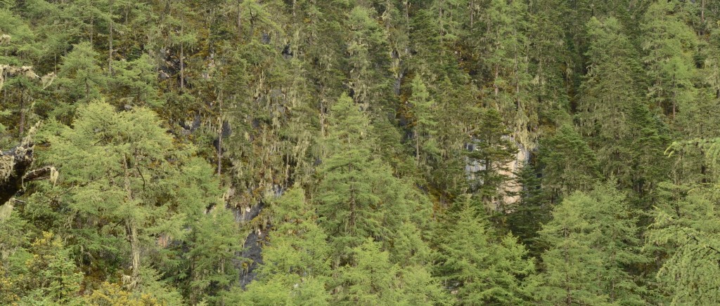
In summer, the scenic beauty here is almost too much to process: subalpine oak/conifer forests hung with lichen, plunging streams, limestone peaks with glaciers at the top. In my own opinion, high mountains of limestone are the most striking, not only because of their uniform, chalky pallor, but something about how the soil settles firm into the ground without the tinselly dust of decomposed granite. And the streams that issue from limestone can be ethereally clear. Whether Konkaling is biologically diverse by local standards, it is certainly diverse compared to alpine regions outside the Eastern Himalayan region, and the summer wildflowers are delightful. Luorong Valley supports some of the highest forests in the world with closed-canopy stands of spruce and larch at elevations up to 4350 m.
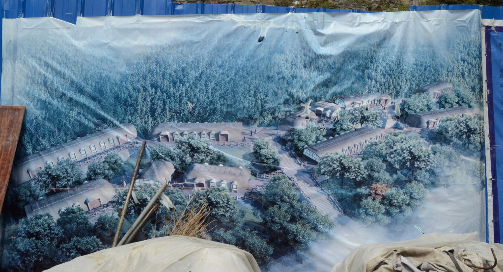
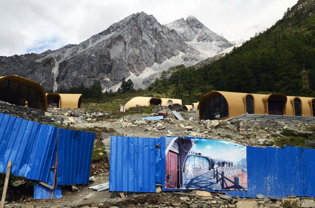
Today the project of constructing Yading continues apace. Dozens of hotels have been built in the county seat of Daocheng and the township of Riwa, the latter being preferable as you will be closer to the peaks and 800 m lower in elevation. The Riwa hotels all look more or less the same, built of stone in a generic Tibetan style. Hospitality services are run mostly by Han Chinese from Sichuan and other provinces, although they certainly pay rent to the local Tibetans. A couple of years ago, Daocheng got a regional airport, one of the highest in the world. During summer 2014, a large reception center was under construction near the entrance to the reserve, and bunker-like accommodations are going in at Luorong meadow where locals sell souvenirs and run the pony concession up to Five Color Lake.
*Facilities under construction at Luorong Meadow, Summer 2014
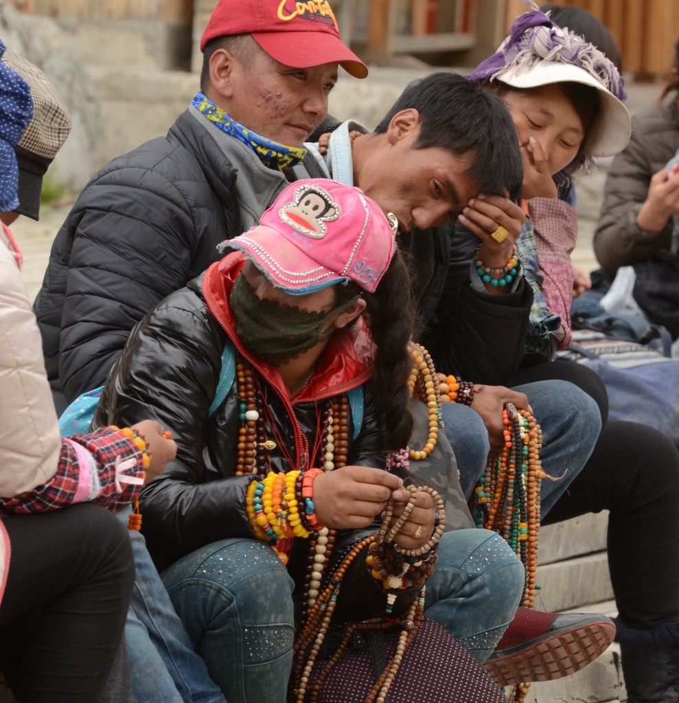
Konkaling’s new generation looks to tourists for money now, at least during the warm months. The nature reserve issues a pea green fleece jackets to its workers who come in every day from the surrounding villages to drive the trams and take out the trash. Freelancers, selling prayer beads, wear their own clothes. They dress urban, contemporary, in jeans and gangsta chic, fashion accessories acknowledge Buddhism and, in solitary with kids worldwide, signal a general disdain for the larger enterprise around them. The girls don’t seem to mind a sunburn.
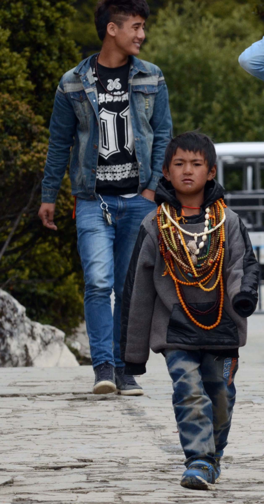
It’s startling to realize that these kids are only three generations away from the murderous ‘bandit-pilgrims’ that Joseph Rock met when he visited Konkaling in 1928. China’s contemporary youth are famously disconnected from the experiences of their parents, to say nothing of their great grandparents. But what a journey these lineages have had through recent generations! Packing up after a day’s work in the park, gossiping and helping each other out, they struck me as cohesive and sincere, neither jaded nor downtrodden. If anything, they were a trifle insolent, lacking that ingrained respect for visitors typical of the more Confucianized realms farther east. Rock got some of this. He compared the Konkaling people to proud, virile Apache Indians, in contrast to the “sniveling serfs” of Muli. If the new generation of Konkaling has yet to gain inspiration from the Chinese dream, they seem sufficient for the time being without it.
